__
ON THE ROAD 2021

ON THE ROAD 2021: SEA-TO-SHINING-SEA BIKE TOUR
Pacific Coast to Yellowstone National Park
June 6 – July 1, 2021
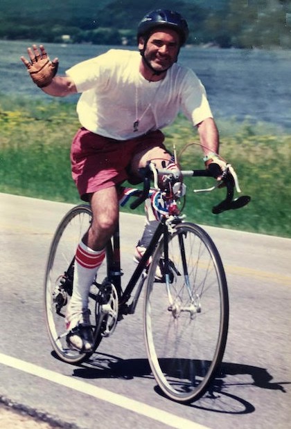

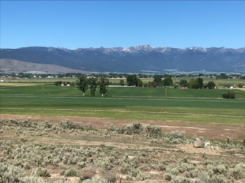
We friends – Joe Donnelly, Chris Tormey and Mary Ann Tormey – first met in college in Vermont in 1976. Here in 2021 we plan to bike 1200+ miles from the Pacific Coast to Yellowstone National Park.
We’ll begin riding along the Pacific coast south of Tillamook, Oregon, and then ride east over the Coast Range to Portland. From there we’ll climb along the Columbia River Gorge through the Cascade Range before following the John Day River through the high-desert country of Eastern Oregon. We’ll descend to cross Hell’s Canyon of the Snake River into Idaho, and then ascend gradually along mountain streams towards the Continental Divide in the Bitterroot Mountains on the Montana border, following very near the route travelled by the Lewis and Clark expedition over 200 years ago.
After a rest day in Missoula, Montana, we’ll climb south and then east into the high Big Hole Valley where Chief Joseph and his Nez Perce warriors battled the U.S Army in their quest for autonomy in the 1870’s, spend a night near the old mining town of Virginia City, and finally pedal upstream along the Madison River towards its source in Yellowstone National Park. We hope to reach West Yellowstone by the end of June, after which we’ll visit our friend Wanda Wilcox at her ranch in Absarokee, Montana – switching from riding bikes to horses before heading home.
In this blog we plan to provide daily updates to family and friends about the (literal) ups and downs of our journey.
We hope you enjoy hearing about our adventures here! If you have any questions or comments during our journey, we would love to hear from you.

The summit is what drives us, but the climb itself is what matters.
– Conrad Anker
2021 Journal
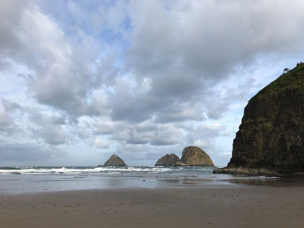
- Day 1: The Journey Begins
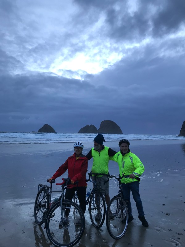
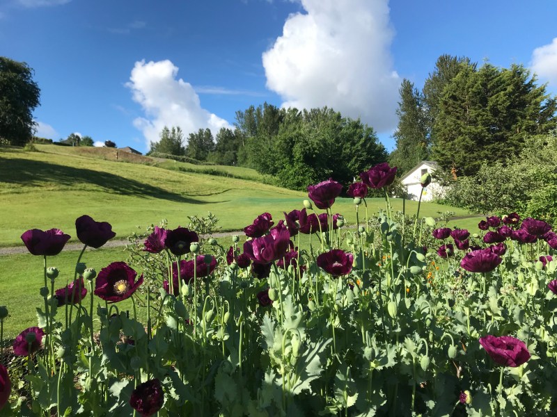
The Rag Tag Riders made it to the their seaside cabin on the west coast in Oceanside Oregon via plane, taxi, bus, and a gorgeous 10+ mile bike ride.
We were treated to a rainbow at dinner which we are taking as a good omen for the trip.

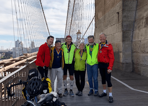
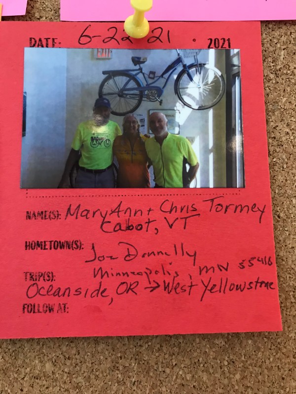
The below photo shows all of us on the first leg of the friends’ multi-year Sea-to-Shining-Sea Tour in 2019! Chris Randall, Joe Donnelly, Kurt Wolff, Mary Ann Tormey, Chris Tormey, and Paul Marshall are on the Brooklyn Bridge celebrating the completion of the ride from Albany to New York City, October, 2019. (Medals courtesy of Annie Huang. Thanks, Annie!)
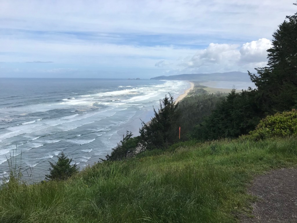
- Day 2: The Rag Tag Riders had a helluva day!
Started with beautiful coastal views in sunshine, hit 101 and log trucks for thankfully only 4 miles, then started up the Nestucca River Road into and over the coast range. Had sunshine through the lower farmland and then hit a 4 hour downpour on our relentless cold climb through the lush forest of moss covered maples and alders, and huge ferns and other vegetation growing on steep hillsides.
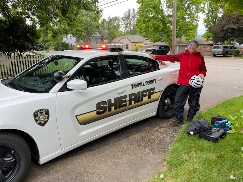
Joe and Chris did 70 and Mak did 60 rugged miles. A very caring couple, in one of the few cars that came by us, called the local sheriff to say that they were worried about us. So Mak got a ride down the last 10 downhill miles to Carlton in the back of a police car!


- Day 3: Wine Country to Portland
In contrast to yesterday’s challenges of relentless climbing and cold rain, today’s journey was much more manageable and far less hypothermic. We started the day riding through lovely pastoral landscapes in the Oregon wine country. After some time safely hugging Portland’s bike lanes on very busy roads/truck filled highways, we connected to Portland’s extensive bike trail system with a lot of help from our friends at Google Maps to reach our destination in Troutdale after 60 miles!
We are spending the night at the base of the Columbia River Gorge. The hotel we are staying at used to be the Multnomah County poor farm before being renovated as a hotel, brewery, winery, and vineyard. We are looking forward to heading up the Gorge to Hood River tomorrow.

We had a delicious breakfast with Yoka and Keefe at the Carlton Inn B&B. We received Dutch shoes as good luck charms! 
There are Kinney’s in Oregon too! 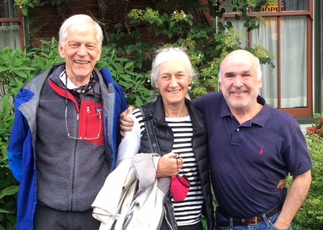
It was wonderful to rendezvous with Morley Marshall Knoll and Jim Knoll in Portland.
- Day 4: Up the Columbia River Gorge
Today was a biker’s dream – beautiful skied with highs in the 70’s, the wind at our back and spectacular scenery throughout our 50 mile journey from the Portland metro to Hood River on the Columbia River Gorge.
The rainy climate makes for almost surreal colors when the sun comes out with so many flowers blooming and lush verdant forests .
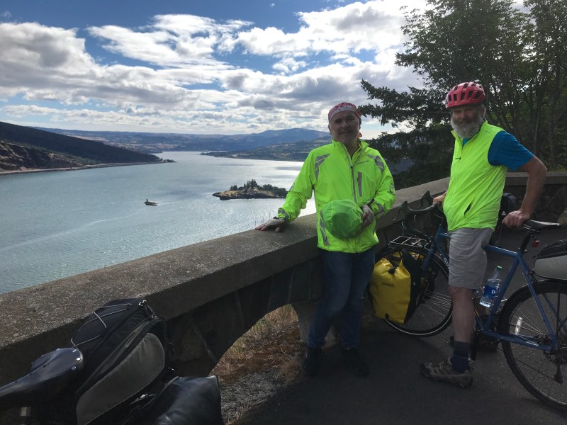
We had views of the state of Washington on the other side of the Columbia River for much of the day . Tomorrow we continue east on the Columbia River staying on the Oregon side. But today was full of stunning natural beauty.
This is from our morning walk in Edgefield gardens. 
Our view up the Columbia River from the Vista House after a 10 mile climb this morning! 
Below is Horsetail Falls along the Columbia River Scenic Highway. 
Here we are repacking panniers after an unexpected “bike portage” along the bike path above Interstate 84 along the Columbia River. 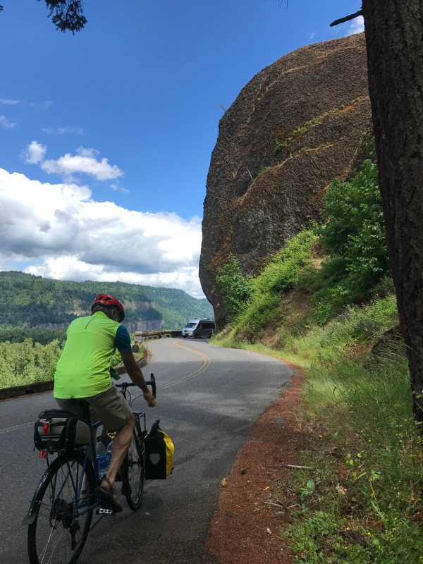
Pedaling along the curves of the 100-year old Columbia River Scenic Highway was amazing. Thankfully no one’s wheels wandered into the concrete gutters lining the road to keep the abundant rainfall off the roadway.
- Day 5: Hood River to Wasco, Oregon
Today we were jet-propelled from the lushly verdant Columbia River Gorge at Hood River, through tan high bluff grasslands overlooking the Columbia River, to sagebrush desert – all in one 59 mile day . We were aided by a steady 20 plus mph wind, which was directly at our backs most of the day. Early in the day we we enjoyed riding on the 11 mile long Mark Hartfield Trail which climbs out of Hood River up to gorgeous vistas of the Columbia River Valley.
Once past Portland there are not many bike trails along our route, so this was a very enjoyable and pastoral stretch. There was a 12 mile section where there were no suitable trails or roads to move east up the Columbia River Valley other than Interstate 84. Though our time on I-84 was relatively short because we had strong winds pushing us along, we hope in the future to only travel on interstates in cars.
Reflection by Joe:
After a day thinking about a steady tailwind pushing us along and aiding us up climbs …
In life, as in biking, we are often more conscious of headwinds than tailwinds. There are many times when I’ve been unaware of tailwinds aiding me on a bike journey; they can be almost undetectable unless they are very strong, as they were today for us.
By contrast, headwinds, even small ones, are apparent . They’re literally in one’s face, and they can quickly move to the forefront of one’s thoughts . There are days when it seemed in a loop ride that I had headwinds the whole way , which is unlikely meteorologically. It’s easy to become focused on these headwinds, and allow them to squeeze out thinking time about positive things, such as how lucky I am to be riding in the first place.
It seems to me the life lesson is to accept the headwinds as part of the journey and not let them take much mindspace. And to try to be more conscious of, and appreciative for, all the tailwinds I have helping along the journey.
I’ve been thinking a great deal on this ride about the tailwinds I’ve enjoyed, most importantly family and friends. Becky provides such wonderful tailwinds for me; she is the wind in my sails both when I’m cruising, and when I am at risk of becoming becalmed. I feel very grateful for so many of you helping me get up those hills even if at times I haven’t been as conscious as I should have been of those gentle tailwinds….
Admiring the morning view of the Columbia River. 
Tunnels and smooth wide paving along the Mark Hatfield bike trail. 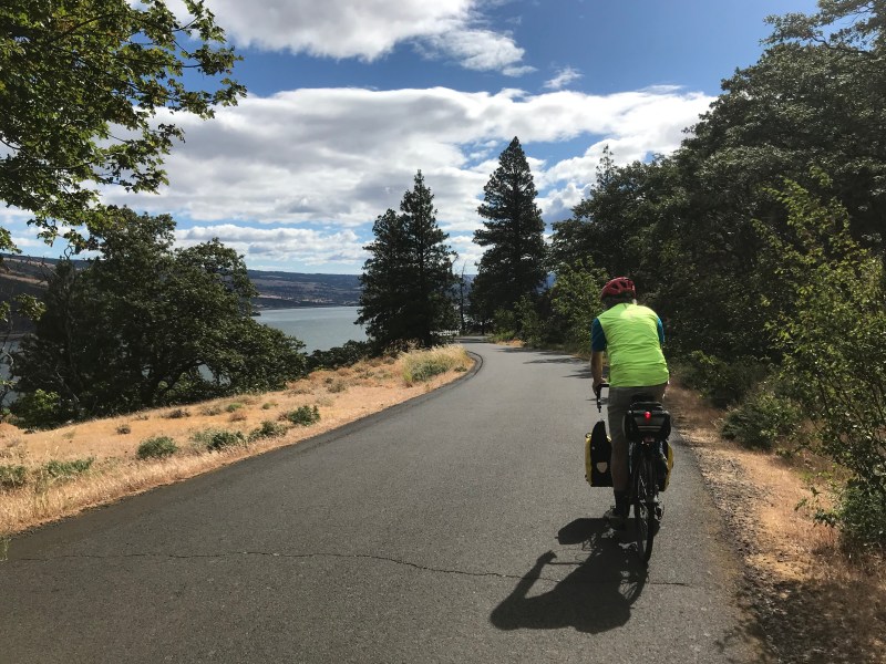

The view east along the Columbia just before descending 4 wonderful switchback miles to almost river level.
- Day 6: Wasco to Condon Oregon. Up, Down, and Way More Up
Today’s 41 mile ride was much more challenging than yesterday’s much longer ride. We doubled our elevation from 1400 to 2800 feet but the major factor was that in the middle of the ride we descended sharply over four miles to about the elevation of the Columbia River (about 200 feet) and then climbed relentlessly over the next 20 miles to our destination at 2800 feet. We had never previously used the first gears on our bikes so often or do long.
Kudos to Mary Ann for successfully completing the route today, a route we most often described during the day as “brutal.” Nonetheless, the remote landscapes (we saw a sign saying “Next Gas 94 Miles”) were beautiful, varied, and otherworldly with so few signs of humans … other than the road winding through them, and all the big windmills, spinning slowly on the ridge tops.
We are now in the Oregon desert. The two types of farms we rode through all day were wheat farms and windmill farms. It’s been a dry spring and the farmers are worried about the winter wheat in the fields, but tonight, after we arrived at our hotel, there was a good rain .
We have now covered about 300 miles and are halfway across the state, hitting our marks.

Windmills were spinning and we too were feeling the wind up here in the high desert. 

Lots of elevation gained, but then lost quickly down to the John Day River. 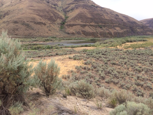
The natural flora here is sagebrush. 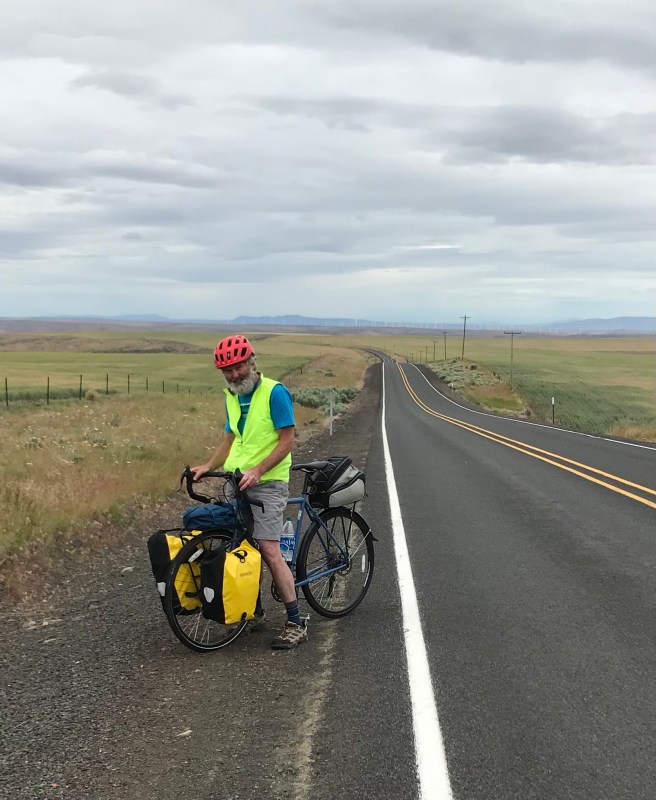
Weary uphill riders! 

This is a map of today’s route … a tough 41 miles!
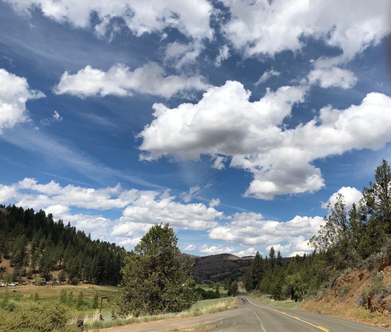
- Day 7: Condon to Kimberly, Oregon
A good day. We travelled 58 miles over varied terrain and over two mountain passes. The second provided us with a 10 mile plus downhill on the other side, a wonderful way to enjoy the beautiful scenery.
Now that we are at higher elevations and beyond the rain shadow of the Cascade mountains there are trees again and the landscape is greener .
We stopped for lunch at former dig site Fossil, Oregon, but didn’t need to stop for gas at Fossil Fuel. We were then joined at the cafe by a large group of bewildered looking Harley riders on a “poker ride” which I first heard as a “polka ride” and was having a tough time picturing . The rules of the poker ride seemed to be as unclear to the riders as they were to us. Chris’ opening line to invite conversation was “You’re all holding maps, what’s the deal?”.
Our hostess for the evening had accidentally double booked the cabin we had reserved so she figured out some unconventional sleeping arrangements for us (see camper I photo for instance) but we are all good and rested and enjoying day after day of heavenly weather.
The morning sky: 
Beautiful small ranch land coming down off of first pass. 
Entering Fossil, OR. Note “Fossil Fuel” sign! 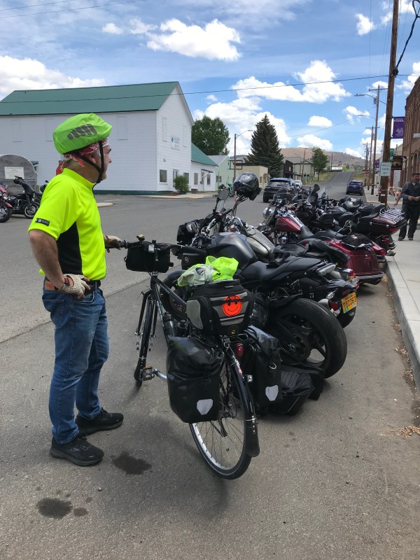
Joe about to re-create the scene from “Pee Wee’s Big Adventure” where his coaster bike falls and causes a domino effect to all the Harleys. Note Joe’s smiley face reflector does not quite cut it with the Harleys. 
Wishing I could trade in for one of these. Could definitely help on the uphills! 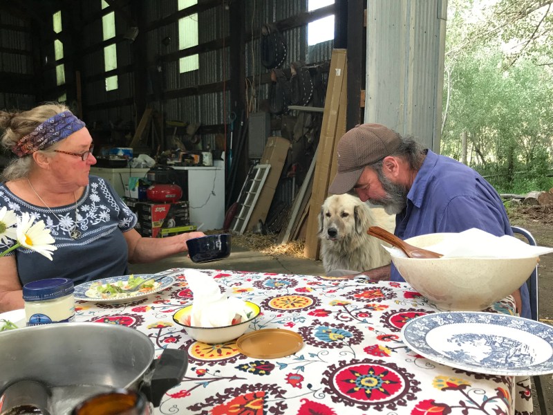
Dinner with our hosts Dan, Jody, and Scruffy in Kimberly, OR.
- Day 8: Kimberly to Dayville
Started today with a delicious egg, cheese, and veggie ranch scramble, roasted potatoes, blackberries, and applesauce. Compliments to chef Jody!
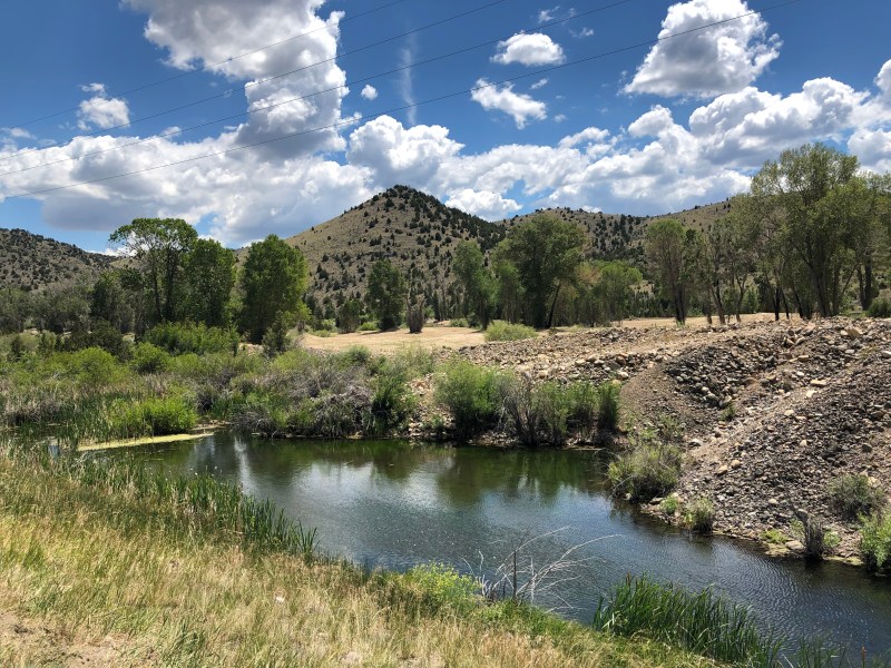
The 24 mile ride up the John Day River was through open vistas of irrigated ranch land, alternating with a little bigger climbs through closer hills of columnar basalt rock cliffs.
We stopped at the Thomas Condon Museum of Paleontology, large animal/post dinosaur fossil museum.
It was 93 degrees, and we were rewarded at the end of the last 8 miles with a delicious lunch at the Dayville Cafe.
Joe took a ride to a swimming hole, but Chris and I enjoyed our air conditioned room. Enjoying dinner now back at the Dayville Cafe!
Reflections
*It’s been very positive day to be out here meeting new people, hearing their stories, and appreciating the opening up of businesses in Oregon after a long COVID year.
*Previously, everywhere we’ve ridden in this part of Oregon has either been racing down into a deep canyon or pedaling slowly back up. But the last 2 days’ journeys have been much more manageable and exhilarating although very hot today.

Morning farewell to Jody and Dan at the Diamond Hitch Mule Ranch. 
Riding upstream along the John Day. This will be the subject of an upcoming reflection! 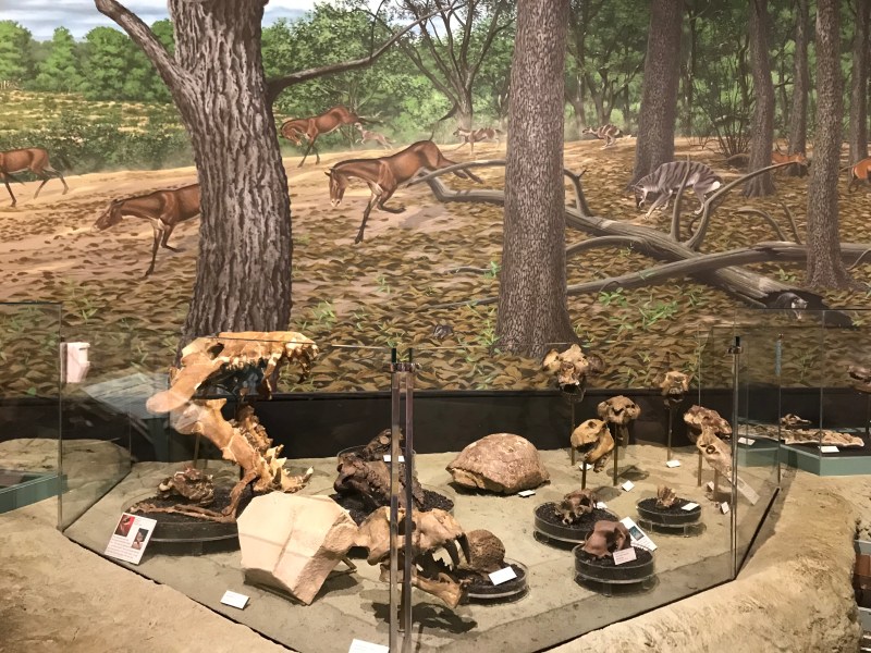
From our visit to the fossil museum. 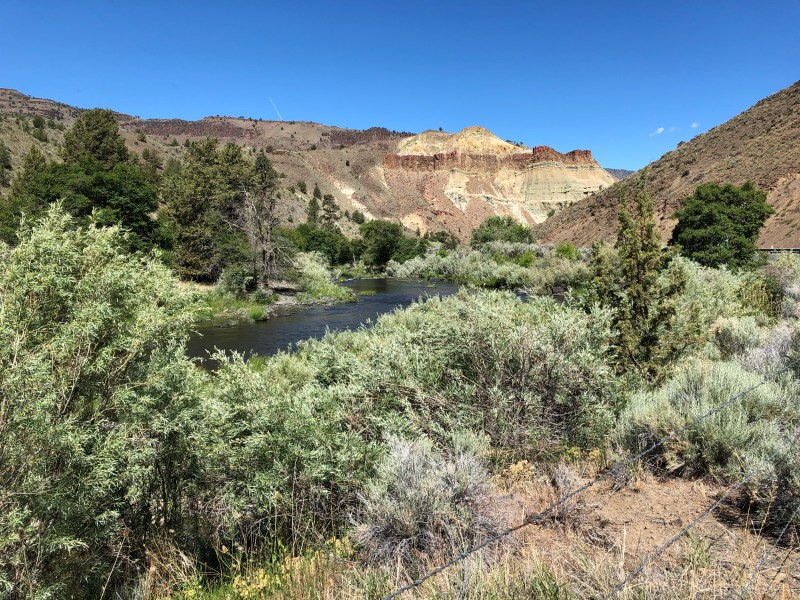
Much of today’s ride was along the John Day River. 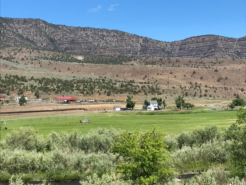
Irrigated ranch land. 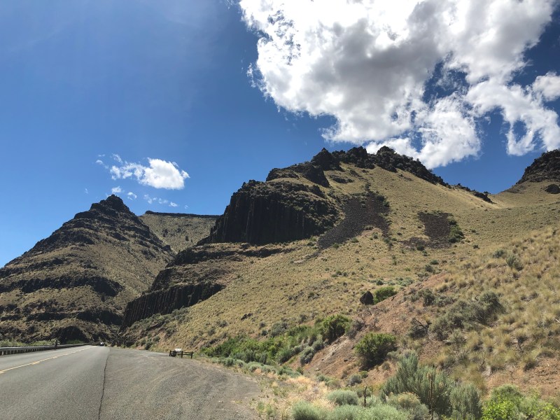
Road above Dayville, very close to where we hooked up with Adventure Cycling Transamerica Trail.
- Day 9: Dayville to Prairie City, Oregon
A beautiful and manageable ride of 45 miles continuing upstream along the John Day River. Though we gained 1100 feet in elevation there were no challenging long climbs. Chris did a great job planning the route and for days to come we will now be on Adventure Cycling’s signature TransAmerica route, their first.
Somewhat ironically given that our trek started with a brush with hypothermia, the heat has been a factor the last two days, with temps in the mid 90’s yesterday in the shade, hotter out on the pavement . We stared riding at 6;15 this morning so as not ride in the midday sun, and are planning to do the same tomorrow, a much more challenging day over three passes.
We are hitting our marks, and surpassed today the 400 mile mark in total miles on our journey.
Reflection from Joe:
Each time I sit down to write a reflection post I’m reminded of a New Yorker cartoon. A woman who is giving a eulogy from the pulpit at a funeral service says “But enough about me and my blog….”
I don’t know what life lessons to take from something that I’ve observed over this journey, but thought I would share it with you.
A large part of our route so far as been alongside rivers, first the Willamette, then the Columbia, and now for several days the John Day River. We ride upstream and have gained more 3500 feet of elevation. Yet most of the time it feels like we are going slightly downhill when we hug the rivers, even when we can see water coursing down the opposite way than we are headed.
What to make of this illusion? Part of it is of course is that we have been lucky with the winds so far and are often being gently pushed upstream. But I think there’s more to it than that. After steep uphills, gradual uphills feel like welcome flat terrain or gentle downhills. It’s all relative; after major challenges normal uphills feel like riding gently downhill , a soft wind at one’s back.

Chris and Mary Ann keepin’ on keepin’ on. 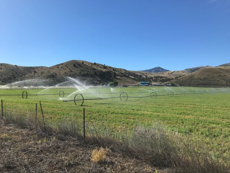
Alfalfa fields being irrigated in the early morning. 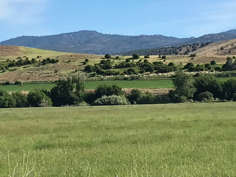
Common views of vegetation along the John Day. 
First hay harvest. Huge square bales! 
Our first glimpse of snow in the Strawberry Mountains as we rode into Prairie City. 
Day 9 route
- Day 10: Prairie City to Baker City, Oregon
We knew by the length and the topography of the route that today was going to be one of the most challenging of our trek, and it proved to be both demanding and spectacularly beautiful.
We travelled 71 miles over three mountain passes, each between 5,000 and 6,000 feet. We are now on Adventure Cycling’s TransAmerica route and their topo map of today’s route showed three steep sided triangles side by side, which captured the realty well. We climbed steeply for about six miles to a pass, descended about six miles through switchbacks and long steep down slopes, and then repeated this twice before descending 26 miles out of the mountains in a river valley. Most of this descent was with a very stiff tailwind, next to a stream, so the day was filled with startling and varied beauty, from lush evergreen forests to snow capped mountains in the distance .
Chris had some mechanical issues with his bike at the end of the day, but we found a great bike store at the end of the day who was able to fix it.
We are approaching both the Idaho border and the 500 mile point in our Trek, and continue to be blessed with beautiful weather and generally favorable winds .
Coming out of the mountains 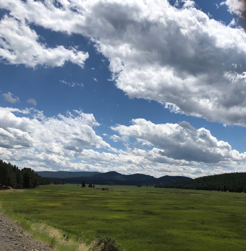
Sky of blue, sea of green. 
Mary Ann at the first of the three mountain passes. 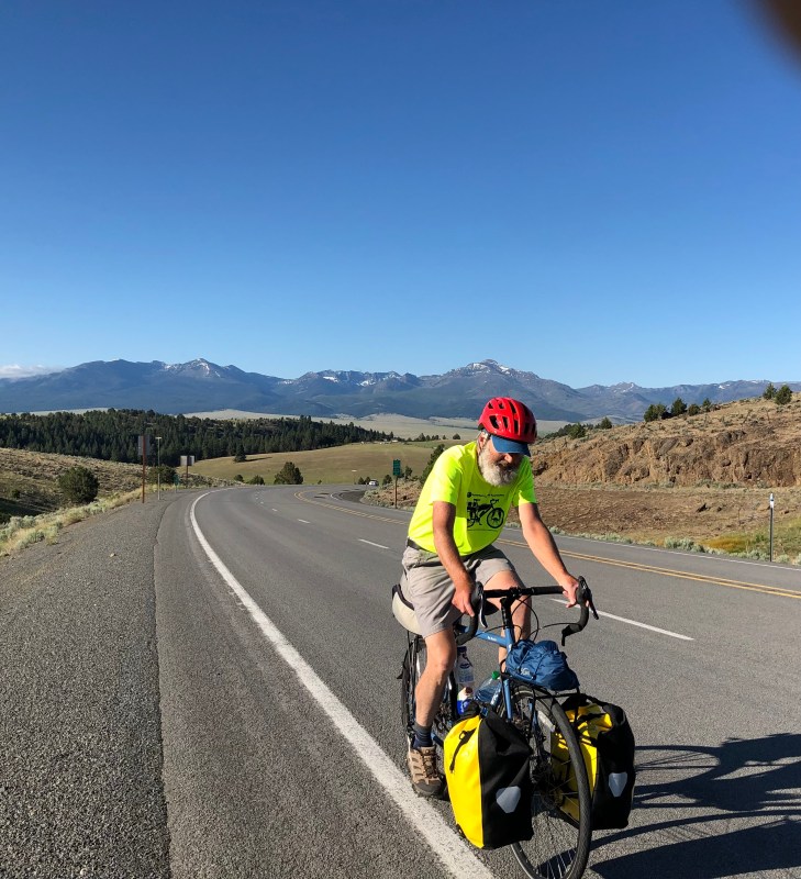
Chris ascending from Prairie City 
Mary Ann and Chris gaining on Joe fast . Much of the day we were, as Chuck Berry would say, “bumper to bumper baby, side-to-side”. 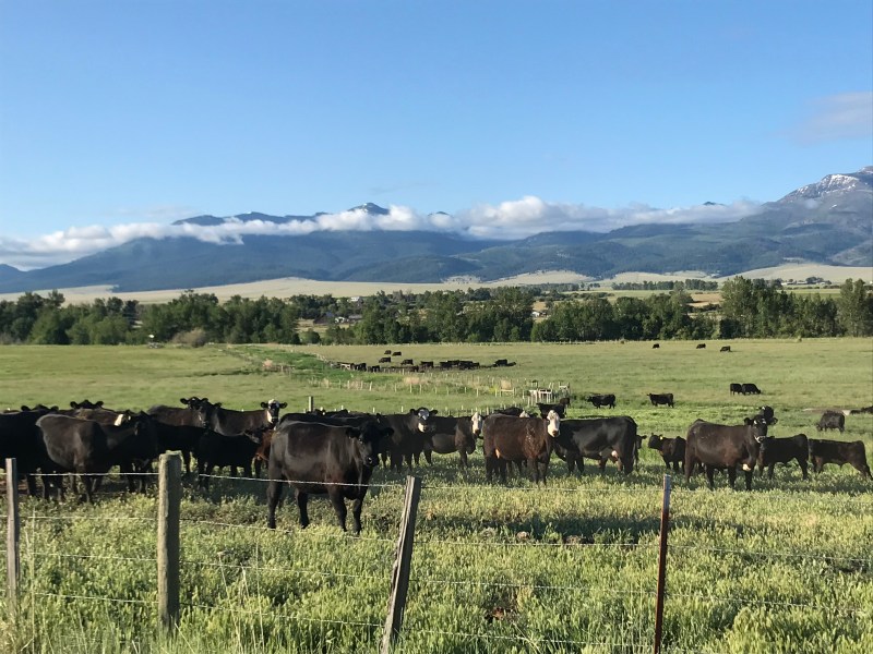
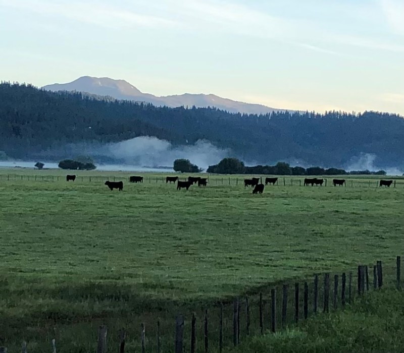
Heading out of Prairie City with the cows and early morning clouds in the distance. 
Second summit! 
Third summit! 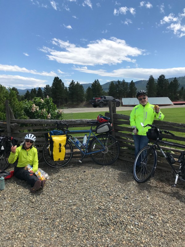
Post summit lunch and brake consultation stop. 
One of the many cool Baker City sculptures outside the Trailhead bike shop where the very friendly folks fixed Chris’s brakes.
- Day 11: Baker City to Halfway
It was a lovely 57 mile day along the Powder River. It started with a 10 mile climb and high traverse over sagebrush rangeland out of Baker City, and then became a 31 mile downhill run along the river through a variety of canyon vegetation and rock.
We had a delicious lunch at Sarah’s Richland Cafe where we met Sherril who generously gave Mary Ann and all of our panniers a ride over a high sun baked divide to today’s destination, Halfway, OR. Chris and Joe were similarly “rescued” about 3 miles from the top by her. They however enjoyed the descent to Halfway.
We are in a broad verdant valley nourished by the Pine Creek flowing south out of the Wallowa Mountains where Joe and Chris did a side excursion while Mary Ann socialized at the laundromat. It was a hot day! We are planning on an earlier start tomorrow because we are headed into even lower hotter territory.
Leaving Baker City, an oasis of green ranch land. 
On the Oregon Trail. We did go see the wagon ruts! 
Powder River canyon vegetation and rocky hillsides. 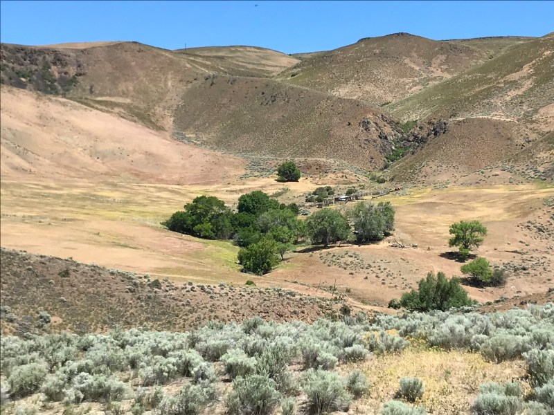
Still coming down the Powder River into much more open dry land.
- Day 12: Halfway, Oregon to Cambridge, Idaho
Passed both the 600 mile mark and the Oregon – Idaho border on a beautiful ride of 68 miles.
The area we are riding through is experiencing a heat wave, so we started riding about 6A, which made for a gorgeous ride in cool temps and car free roads above Pine Creek with the early morning sun slanting through dewey air to a pristine mountain stream below. Bike heaven.
We crossed the Snake River into Idaho and then spent much of the day climbing over a ridge, following Brownlee Creek upstream for about 8 steep miles. We then had a long descent to our destination of Cambridge, Idaho. A good day with varied, beautiful terrain.
Reflection from Chris:
Today we experienced the full range of temperature, terrain and bicycling speed. This morning we left The hamlet of Halfway in the broad green Pine Creek valley at 6:00 while it was still cool, and soon were speeding down its canyon as the clear stream rushed below us towards the brown depths of the Much deeper Snake River Canyon. We all agreed that the 90 minute descent past rock outcrops above and dense riverside greenery of dense cottonwoods and wild roses and Syringa in bloom with the sun just climbing above the ridge below us was among the best stretches of bike riding we’d done. Having reached the low point of our entire trip at the Snake at 8:00 AM, we then slowly made our way upstream along its canyon with the day heating up- the few fishermen out in boats hugging the shady side of the flat water of the 2 reservoirs we cycled along.
And then the paved road climbed up a major drainage leading away from the river into the high hills east of the river, and we soon were taking turns grinding up in our lowest gears along that stream when we could manage, and walking our bikes when we couldn’t. We had the company of occasional motorcyclists and trucks-pulling-massive-campers and horses in the steep pastures, and the refreshment of a cool breeze sweeping up from the deep lake far below. At mile 7 the road finally flattened and began to descend towards our stay- over town of Cambridge Idaho, and as we had a welcome 2 pm lunch over crackers and apples and cheese and warm water at the pass, it seemed impossible that we’d actually felt cold when we’d started out 7 hours earlier.

Leaving Halfway in early morning. 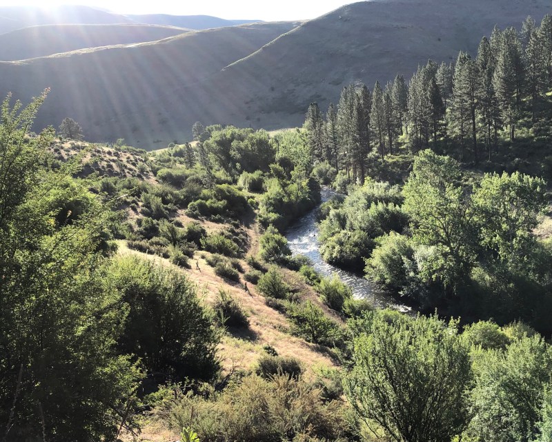
Early morning sun rays come down on Pine Creek 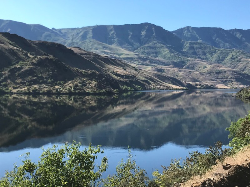
Riding along the Oxbow Dam reservoir. 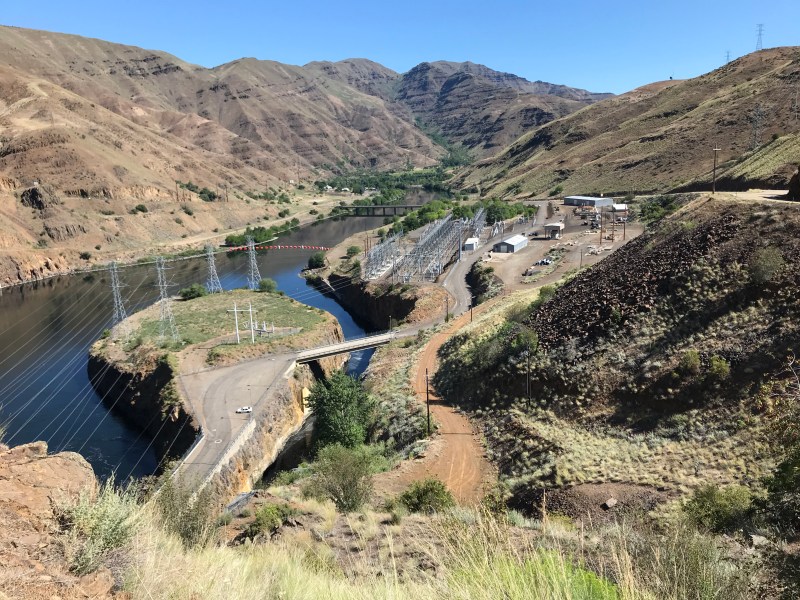
Looking down from the huge Brownlee Dam at all the infrastructure and the way we had traveled. 
Chasing Joe around the s-curves along the edge of the Brownlee Reservoir. 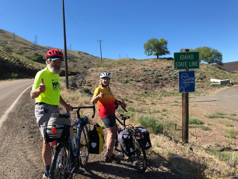
Entering Idaho. The signage marking our long-anticipated entry to Idaho was a bit less dramatic than anticipated. We crossed the Snake River on a little used bridge on a a small road with little traffic. Reflection from Mary Ann:
We started our day in Halfway at 6am in order to beat some of the 90+ degree heat. It was a beautiful low light 17 mile ride down to Oxbow Dam. After a climb up to the reservoir behind the dam it was a pretty level ride along the dammed Snake River. We then crossed into Idaho and climbed up to the Brownlee Dam and snaked along its reservoir. The challenge of the day was when we started up the East Brownlee Creek Canyon. It was a long 10 mile slog to the top in pretty extreme heat! We all did our share of walking our bikes due to the grade and the heat. We did have a gentle cooling tailwind that helped us along a little.

Due north is on the left side of this map. We started out 17 mile descent to Cambridge at the Brownlee Summit on above map. It took us through pretty dry, recently burned Pine Creek River valley (below).

- Day 13: Cambridge to New Meadows, Idaho
First an update on the trek: we rode 47 miles up and over a big ridge and then upstream to New Meadows. For the first time since the Portland Metro, road traffic is a focus as we are on a major commercial artery with much truck and camper traffic. The highway was almost certainly not nearly as busy when the TransAm route was established decades ago. As we plan to be on this road for another two days we hope to mitigate against the traffic (and the heat) by starting very early in the mornings. We are now 650 miles into our journey and continue to hit our marks.
Reflections from Joe:
Sixty five years ago I was born in New York City (population about 7 million) on this date, and today I am in New Meadows, Idaho (population 362). I am very grateful to be here.
My good friend Chris Randall said it’s difficult to remember where we were on birthdays, even milestone ones, but that I’ll always remember this one. I think he’s right. I’m very grateful to Chris and Mary Ann for making this trip possible, as I probably would not have done it alone, and it’s clear to me now that doing a trip like this alone would be very risky. I’m also grateful to Becky for her unflagging support of my dream of crossing the county by bike.
Music is often playing in my head, the song playing at any moment selected subliminally by what I’m experiencing. There’s a lot of Chuck Berry on the playlist, especially on a road trip where lines such as “When I was motorvatin’ up over a hill” and “Rain water flowin’ all under my hood / Knew that was doin’ my motor good” perfectly capture the moment.
But the majority of the “playlist” consists of Bob Dylan songs, in part because the work is so vast and varied there’s a line which seems to suit every eventuality.
Today Dylan’s “New Morning” was playing a good part of the day:
“Today’s the day when all my dreams come true. / So happy just to be alive, underneath this sky of blue…”
On this New Morning, in the fortuitously named town of New Meadows, I am so fortunate to be alive and experiencing all we are experiencing. I am grateful for health, grateful for my wonderful wife, for our three adult children, two fabulous sons-in-law, and our six grandchildren we are so proud of … and grateful for all of you, family and friends.
I’m glad this birthday was so different because I hope it marks the opening of a new chapter. I wish Becky could have been here too but she arranged a cake and champagne and was here in spirit. My heart is filled with gratitude.
Time to go climb some hills with Chris and Mary Ann! Van Morrison’s playing in my head now; lines about smelling the sea, feeling the sky, and letting our souls and spirits fly.

- Day 14: New Meadows to White Bird, Idaho
A good day of 67 miles stared in early morning chill and ended in blistering heat: mid 90’s with barely a tree to seek cover under can feel overwhelming on the road on a bike so we have shifted our schedule to start earlier.each morning. Extremely hot and dry weather is being discussed everywhere we go. And the sight the other day of the Brownlee Dam with virtual no water coming down the spillways felt ominous.
Today we rode about 50 miles downstream along the Little Salmon River . We had ridden better than 30 miles by 9a with very little pedalling, and the landscapes we rode through were lush, misty, and beautiful. Fortunately the traffic was much less today on an early Saturday. The afternoon mikes were tougher and much hotter, but overall it was a good ride and we are now well over 700 miles into our expedition.
The day ended with the owner of our lodging, who it turns out is a Nurse Practitioner , performing minor surgery outside on one of our team members. Hopefully sunlight provided good sterility assurance , because there was a lot of it on the “operating table”,.
In the late afternoon we finally took a cool dip in the River next to our overnight stop, and suddenly the high 80’s heat felt good,
Meadows near New Meadows, 6:30A, air temps blissfully in the 40’s . 
Morning Mood: sunrise in the valley of the Little Salmon River. 
Mid morning time check: gaining an hour at this bridge. ( Among its many natural and man made wonders, Iowa boasts two time zones). 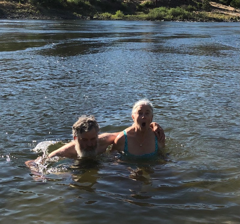
Air temp high 90’s. Wonderfully cool mountain water. 
Huge fresh-picked selection of riverside fruits at the Fiddle Creek Orchards. The owner (who planted the trees 4 decades ago) was manning the stand with the help of his daughters and grandkids) and was generous with stories of past calamities (that flood washed most of our melons into the river!) and free apricots. 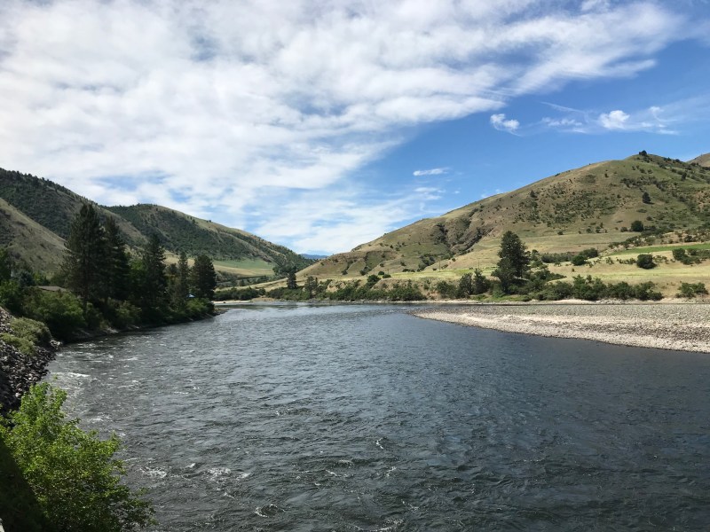
Looking back up the valley of the Little Salmon River down which we pedaled 60 miles today. 
Along the Little Salmon River.
- Day 15: White Bird to Syringa, Idaho
A good day with amazingly varied terrain. We started the day early with a 13 mile climb with over 2,500 feet in elevation gain on an old highway which has been superseded by a major highway – so we saw one car in the three hours we climbed over that ridge via switchbacks which clunked and climbed. The views during the ascent were breathtaking; we all agreed it was some of the most beautiful terrain we have seen.
Once over the summit we coasted down to lovely agricultural land. From there we could see the range of the Rockies we will begin crossing tomorrow on our way to Missoula, Montana. We passed 750 miles on our journey and are glamping tonight in walled tents without power, but with wood stoves and bathtubs. Kudos to Chris for finding all of these varied and interesting places for us to stay each night. Tomorrow is daunting with 71 miles planned and lots of elevation gain as we make our way up to Lolo Pass.
The first of many views looking back on morning climb. 
We are in horse country! 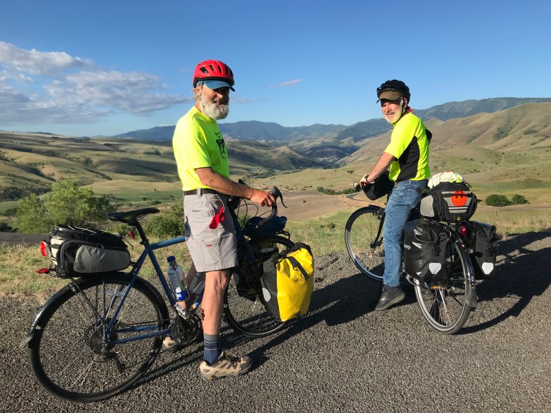
Looking back to White Bird.
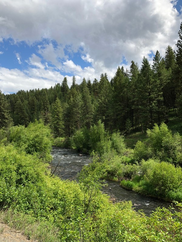
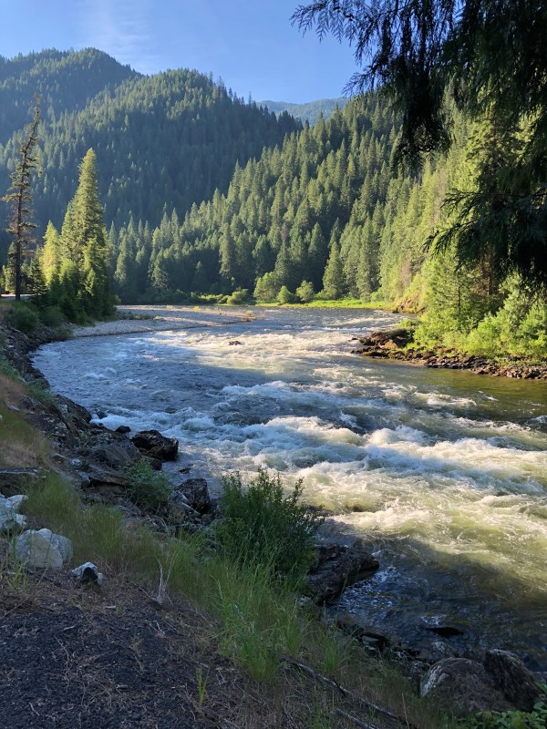
- Day 16: Syringa to Powell, Idaho
A challenging day through gorgeous terrain. Our 71 mile route followed the Clearwater and then the Lochsa Rivers upstream into the Bitterroot Range separating Idaho and Montana. The road hugged the rivers almost the whole way, through canyons of tall blue / green conifers. Despite an early start the midday sun and heat was challenging, and we got split up for a period, Joe rode an extra 8 miles before locating Chris and Mary Ann. All’s well that ends well but Joe was ready for an extra lemonade at the end of the day!
Tomorrow is a challenging route as well as we will ride over the 5,200 foot Lolo Pass before descending 34 miles into the Bitterroot Valley and then Missoula, and cell phone coverage for the first time in several days. It feels like we’ve been in very remote county for a long time.
We are approaching the 900 mile mark in our expedition and are looking forward to a rest day in Missoula!
Pretty much the view for 71 miles today . The trick was to not become desensitized to the astounding beauty mile after mile.
- Day 17: Powell, Idaho to Missoula, Montana (!)
A big day as we surmounted one of our most daunting passes and entered our destination state – Montana.
The Lolo Pass was crossed by Lewis & Clark so there was a great deal of historical information, including the fact that they trudged through deep snow pack in the pass on June 29th, 1806. It looked like the snow pack was gone this year well before June 22.
We rode a total of 57 miles today and have now passed the 900 mile mark on our journey.
The highlights of our Lochsa Lodge, ID to Missoula day in pictures. Making it up to Lolo Pass by 8:15! A delicious lunch at Lolo Peak Brewery. A great visit at Adventure Cycling with Max who offered us free ice cream, sodas, and bandanas. And of course we got our picture on the wall!
Descending into Montana along the Lolo Creek after riding up and over the Lolo Pass. 
- Day 18: Rest Day in Missoula, Montana
A quiet, cloudy, cooler day with light rain. As we haven’t had a cloudy nor cool day since near the Oregon Coast, it feels really good. We devoted the day to doing exploring the city, bike tune-ups, doing laundry and spending time with friends.
The Ragtag Riders at Adventure Cycling headquarters in Missoula. It’s customary if riding on their signature TransAm route to stop and have one’s photo taken to then be placed on a big wall. A fun visit: the staff were great. Reflection from Joe: Two Better Angels of Our Nature.
The day before yesterday I observed two people who came and went like angels. They helped that day, and they had sweet wakes behind them that are lifting me still and causing me to reflect on how there are opportunities to help all around us.
The first “angel” was an exchange student from France. Though I sat with her at a restaurant table outside of the Lochsa Lodge near the Lolo Pass, she was journaling and I was reading a book so beyond the quickest of “where are you from and what are you doing in this remote stretch of Idaho?” type conversation, I know nothing about her.
The moon was rising from the mountain in front of us when we heard a loud thud. A small yellow song bird had flown full speed into the big plate glass window behind us and now lay nearly motionless but quivering on the patio below the window. Several diners turned their heads to try to figure out what had occurred. The small yellow songbird lay quivering on its side on the patio floor in front of the window. There were a few gasps. I heard one person ask to nobody in particular if the bird was dead.
The exchange student walked over and gently picked the bird up with a napkin. A diner who was closest to the bird asked the young woman “are you going to put it out of its misery?” to which she didn’t reply. She carried the bird over to the rail of the patio and made a small bed of paper napkins. She righted the bird and gently stroked its back . She then took a butter knife, poured a drop of water on the far end, and held it in front of the bird’s beak. For at least five minutes she held it there in front of the tiny bird’s beak with no response that I could see, but later I was surprised to see that the bird was trying to drink. The young woman then filled a teaspoon with water, brought it to the bird, who was was by then clearly drinking from it.
“I’m worried the bird has a broken wing or a broken leg” she said – the only thing she had said since she had started tending to the bird and to no one in particular – and kept the spoon at the bird’s beak as it sipped intermittently. This went on for many minutes and I was struck by how focused the young woman was on the bird, even as time passed with little change .
Then, with no apparent warning, the bird flew away, doing a few graceful curlicues in the air before flying off toward the mountain. The young woman sat down again at our table, gently smiled, and resumed her journaling…
The other “angel” who touched earth that same day had a very different physical form – he was brawny middle-aged sun-darkened working guy with a broad smile. Chris remembers flagging down his white pickup, but from my vantage he seemed to appear out of nowhere just when things were looking dire: energies very low after 50 miles of steady uphill riding, the relentless sun straight above us with no significant shade, the stultifying heat we have had so much of in the afternoons relentlessly bearing down on us . Before we knew it Chris and Mary Ann’s bikes were in the truck. He asked Chris how far it was to the lodge. Twenty miles Chris said. No problem .
This angel was named Mike. No doubt given his rig, demeanor, and industrious comportment, Mike was on his way to do something useful when he stopped to help our team at a crucial moment, but you would never have known that watching him in action at that pulloff. One of the things I will remember most is him pulling six packs of ice-cold Gatorade from a cooler in the back of us pickup and placing bottles in each of our hands. I can’t think of an ice cold drink ever tasting so good. And then he was off down the road, with me thinking who was that guy and how did he materialize out of seeming nowhere at that exact moment?
I believe we all leave wakes behind us every day. Wakes can be gentle and gently lift things, or they can be damaging . Most of us are pretty unaware of our wakes, but they’re there, and we have the ability to make them helpful and not destructive.
A lot of you reading this knew Fran Hullsiek, who was a model of finding opportunities to be an angel many times. What Fran taught me wad that it’s not only willingness to be a Good Samaritan if the opportunity presents itself , it’s also the gift of being able to SEE those opportunities that most of us don’t because we’re going above our lives.
So here’s to the angels of Monday in Idaho: May the spirit of the young woman who nursed the bird soar as that bird did. May someone swoop into Mike’s life someday when he is in need, and maybe hand him some ice-cold Gatorade before smiling and then setting off in a cloud of dust. And may we all find – look for and find – opportunities to be angels ourselves, because we’re all in this together.
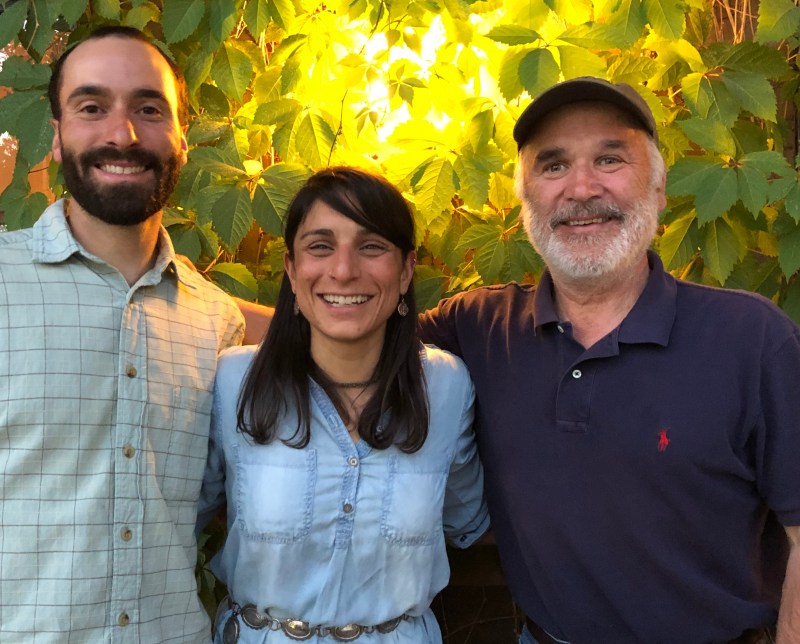
After dinner with Kellie Carim and her fiancé Tyler Alberthsen. Kellie is the daughter of Joe’s dear friends Hatim and Carolyn Carim.
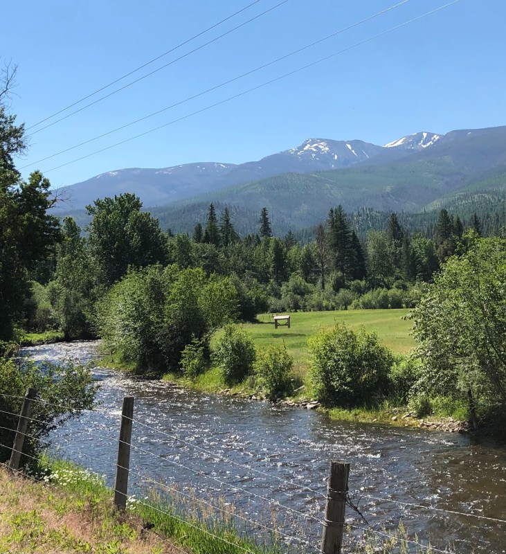
- Day 19: Stevenson to Darby, Montana
Today we took the road less travelled, and it made all the difference. We travelled gently upstream along the Bitterroot River. The first part of the ride was on a bike path which ran along a major highway – a safe, easy but very noisy ride. We then turned onto Adventure Cycling’s alternative route off the highway – we don’t think chosen as often because it is longer and mostly on a dirt road – and were awed by some of the most spectacular scenery we have seen so far. The Bitterroot Mountains are very beautiful: jagged and sharply vertical like the Tetons, many of them with snow in the higher elevations. The alternative road hung high as it wound through the valley, offering one outstanding view of the mountain range (and sometimes the river below) after another,
The attached photos don’t do justice to the beauty. In order to enable selfies, IPhones have extreme wide angle lenses (the wider the angle of the lens the greater the depth of field which is the area in focus). A disadvantage of wide angle lenses is they accentuate foreground while pushing out things in the distance, making them look much farther away (the opposite of a telephoto effect). So the mountain range which looks so far away in the attached photos were much closer and more stunning in reality.
Tomorrow promises to be one of the most challenging days of the trek, with a lengthy climb to almost 7,300 feet, two thousand feet above the Lolo Pass. We will start early to get as many riding hours as we can, avoid the continued stultifying heat, and the mid day sun which seems especially intense out here with the dry air and high elevations.

Chris riding the less–travelled dirt road above the Bitterroot River. The Bitterroot Range is in the background. 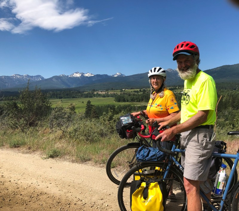
These photos do not do justice to how beautiful this valley is. 
The Bitterroot River descending from the Bitterroot Range of the Rockies .
- Day 20: Darby to Wisdom, Montana
We have found wisdom! Or at least the town of Wisdom, Montana. Chris gets the quote if the day award for his (too true) comment “I think Wisdom is up ahead, just over that ridge..”
We are celebrating because we were able to surmount the two 7,000 foot plus passes, which were actually very close to each other. There was a relentless 13 mile climb to the first pass but we started very early today to avoid the heat and the elevation helped with the temperature as well. Mary Ann was impressive on the climb, attacking the ridge like a Sherpa on wheels.
We covered 68 miles today and are now over a thousand miles into our trek. Tomorrow is a challenging ride to Dillon, and we will pass over the 7,360 Big Hole Pass, but for now we celebrate a very successful ride today.
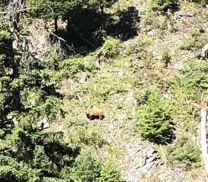
We spotted a BIG cinnamon colored grizzly on the way up to the pass today! Luckily he/she was separated from us by a very deep ravine. It was interesting to watch as it climbed a log and dug in the rocky soil. – Mary Ann 
Moonset outside our lodge prior to our departure this morning. We are now staring much earlier I each day to minimize riding time in the afternoon heat. 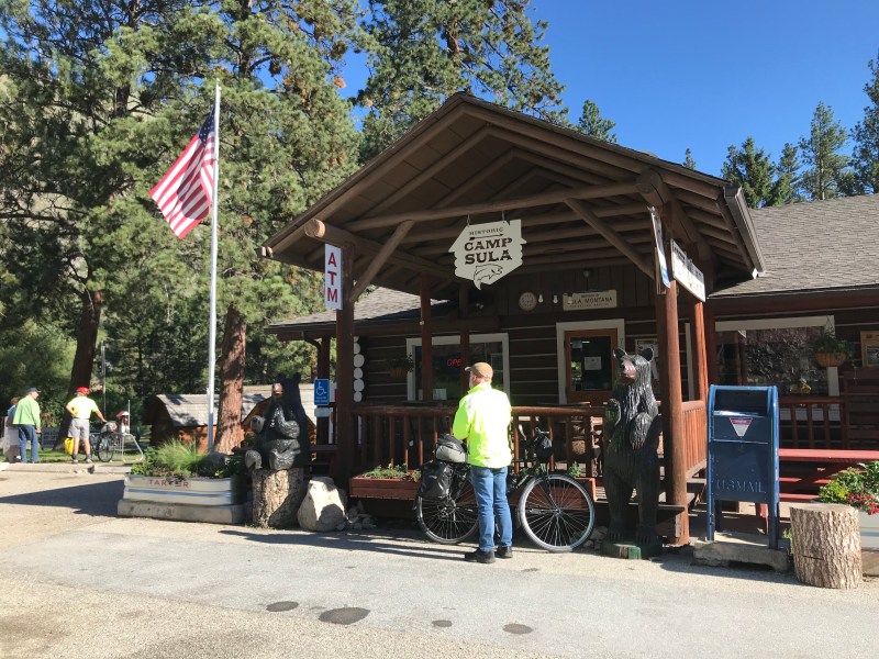
Breakfast stop at Sula Camp at 18 miles before our climb. 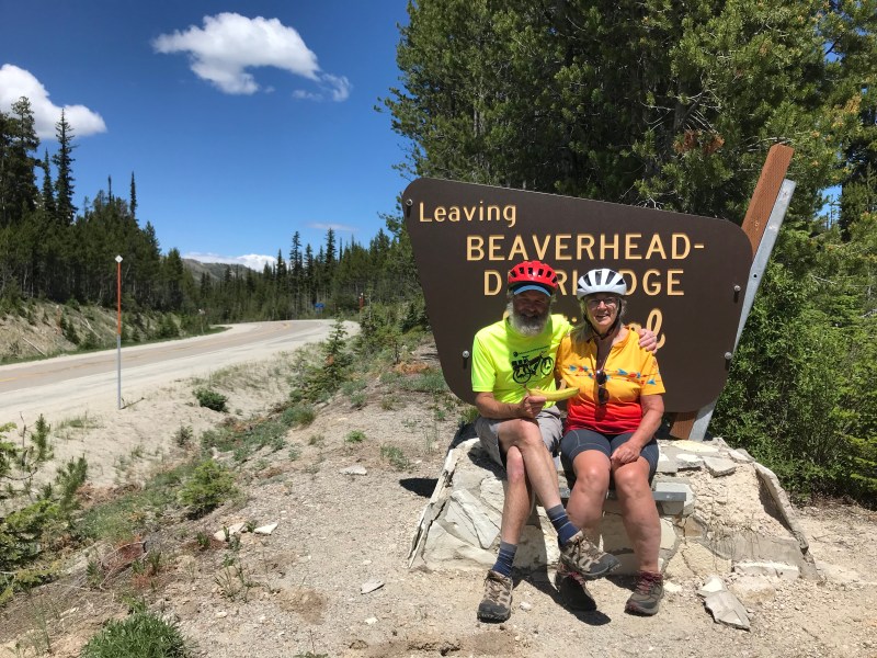
No summit signs so we stopped here just before the decent. 
Clouds rolled in during the afternoon. Rarely have clouds been so welcome . 
Montana fencing across from the Big Hole Battlefield. We spent some time at the visitor center. A very important story told there of Chief Joseph and the Nez Perce. Such an embarrassing and horrible part of our history.
- Day 21: Wisdom to Dillon, MT
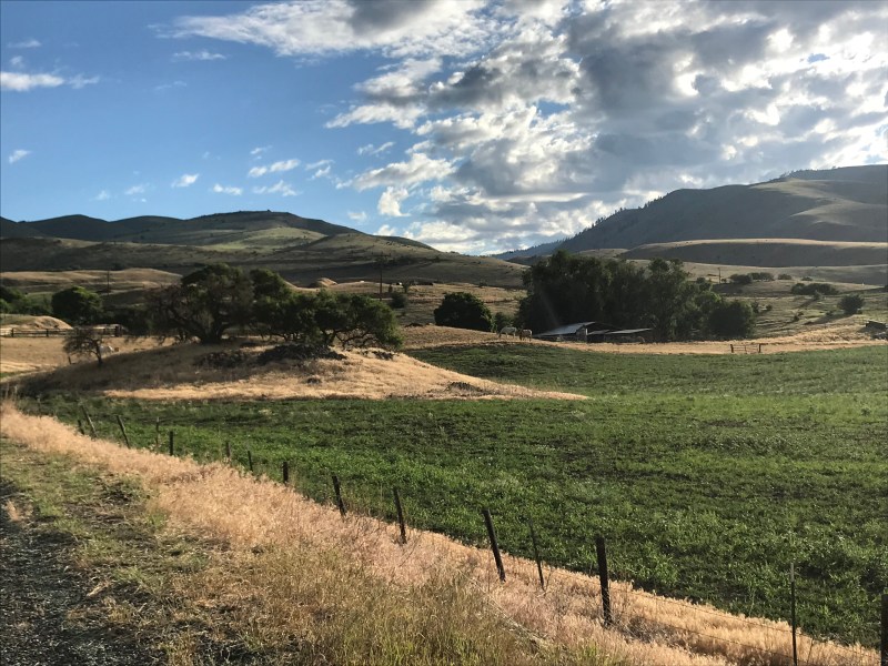
Today was our last long day (65 miles) and it started beautifully cycling through the Big Hole Valley filled with rich pastures and hay land and surrounded by snow covered peaks. They had just just flooded the whole valley which produced our first contact with mosquitoes on the whole trip. Luckily they weren’t out yet on our early morning ride.
Had a delicious breakfast at the Jackson Hot Springs Lodge surrounded by a massive mounted grizzly bear, full bodied puma, and other assorted antlered specimens.
We then pedaled out of the valley over 7400 ft Big Hole Pass helped by a mostly gentle grade and following breeze. We continue to meet another group of cyclists with a sag wagon going in our direction. Their friendly driver Mary Ann stopped and let us use their pump while on the road today.
We dropped down into the Grasshopper valley and then headed back uphill over the Pioneer Mountain Range into a really strong headwind which made reaching the second pass, Badger Pass, way more difficult than the first.
The long 13 mile descent into Dillon was heavenly!
We met another angel today. We stopped at the Dillon emergency room to check out a tick bite on my head that I was a little worried about. A very friendly nurse came out to the lobby, checked to make sure there were no Lyme disease symptoms, and saved me a real visit to the ER. We have met so many friendly helpful people all along our journey!
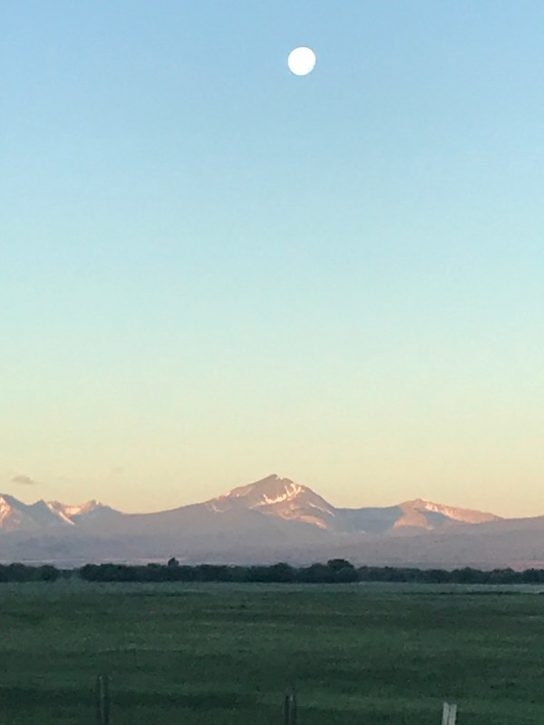
Early morning ride through the beautiful Big Hole Valley from Wisdom to Jackson, Montana with the moon setting over the Beaverhead Mountains to the west. Temp low 40’s and a gentle climb. Definitely a favorite part of the trip! 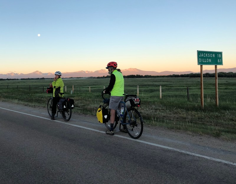
On the road again: Chris and Mary Ann at 6A ready to head out on the trail . Note the moon setting . This photo does not do justice to how much bigger the mountains and moon were in reality . The 20 mile early morning ride up this valley was one of the most lovely rides any of us has ever taken . 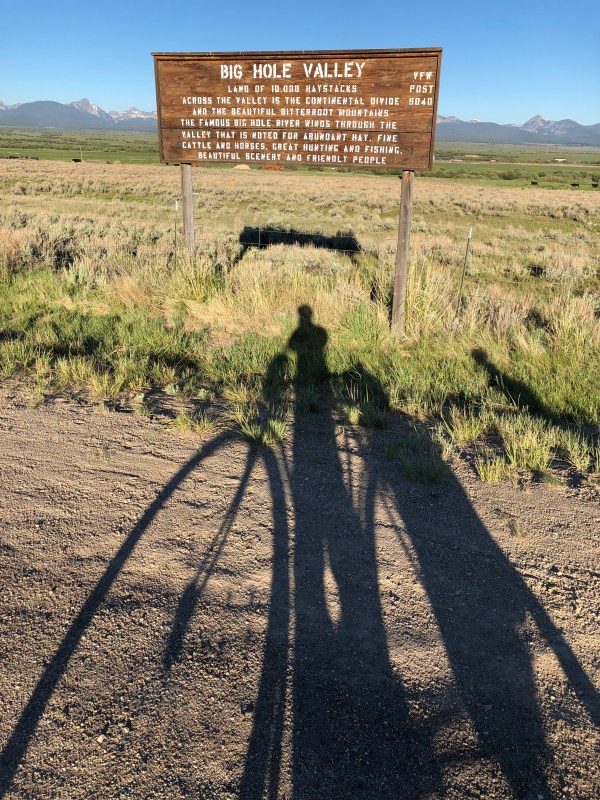
Early morning along the Beaverhead Mountains, a range which separates part of Idaho and Montana. 
Atop the Big Hole Pass, the highest pass of our trek 
Chris and Joe celebrating the successful ascent to Big Hole Pass with Mary Ann. The second pass of the day, to be reached in the afternoon, proved much more difficult due to high winds, but we were then able to descend to Dillon as planned.
- Day 22: Dillon to Nevada City, Montana
A beautiful day’s ride of 57 miles through varied terrain.
We rode about 23 miles downstream along the Big Hole River, past Beaverhead Rock, a massive outcropping important to many Native American tribes who lived in, or migrated through each year, the lush valley. Sacajawea introduced Lewis and Clark to it when they passed through this area.
We then turned southeast for 30 miles or so and fortuitously the wind shifted to stay at our backs so we continued to be jet-propelled. We did have strong headwinds for the last 8 miles or so as we passed through a dry canyonland that once bustled with gold mines but is now mostly deserted . The headwind time reminded us, as it did yesterday at the tip of the second pass , how lucky we have been with winds since we started 3 weeks ago today.
We had hoped to dance the night away in nearby Virginia City at the annual “Scandahoovian Woodstock” festival, but unfortunately it was cancelled a second year in a row because of Covid. It’s been a long time since we barn danced in Vermont in the 1970’s.
We are now well over 1,100 miles into our journey and continue to hit our marks, thanks in large part to those winds and to a remarkable string of beautiful, if atypically hot, days. Our trajectory is now slowly turning toward our planned destination of West Yellowstone.
The arid terrain we are now winding through. 
The lush valley of the Big Hole River. 
The Big Hole River Valley was lush and fertile. When we turned southeast of it into another valley the terrain became more desert-like. 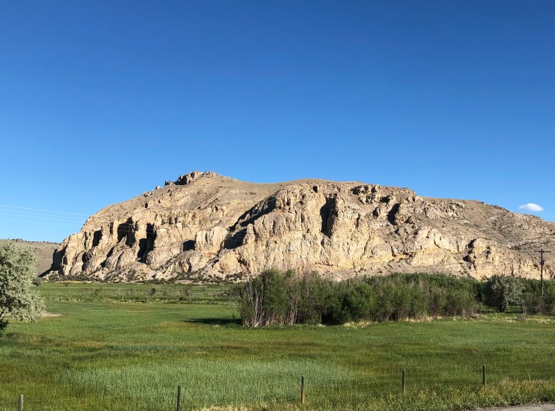
Beaverhead Rock – important landmark for Native American peoples for thousands of years, made familiar to Lewis & Clark by Sacajawea. 
Virginia City, Montana from the ridge above town. This 19th century gold mining town was the first state capitol of Montana. It once had a population of 20,000 people, it now has 158 residents. 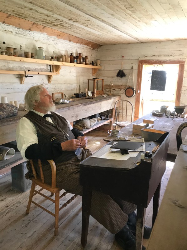
Mary Ann and I toured the assemblage of late 1800’s frontier buildings in Nevada City including the Assay Office where this very learned gentleman described the process to “assay” the amount of gold and silver brought in by miners. Lots of great chemistry, geology, and mining history to learn from him. – Chris 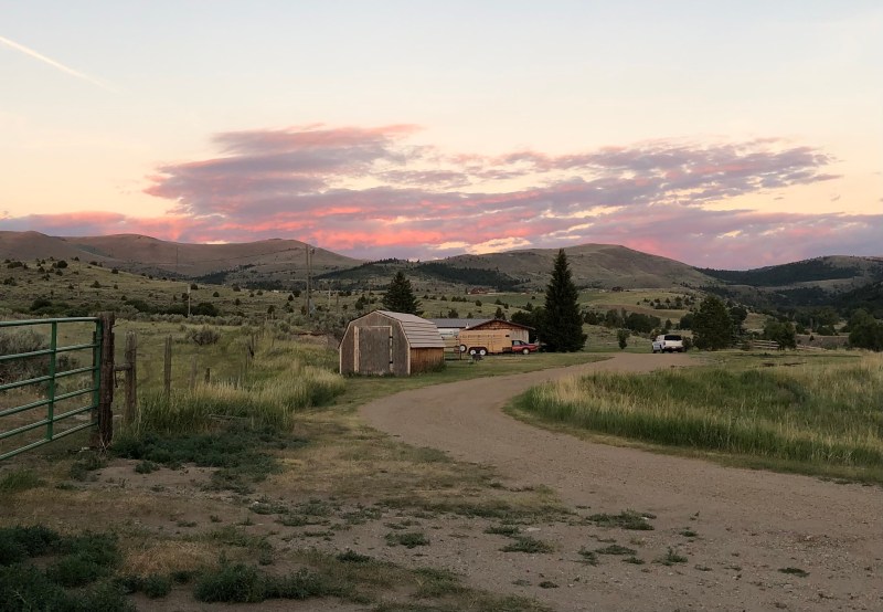
Montana sunset.
- Day 23: Nevada City to Ennis, Montana
A semi-rest day before our final push started with a 1,000 plus foot climb over the final pass of our journey. On the other side of the ridge lay the stunning Madison Range. We dunked in the Madison River, which has its headwaters in Yellowstone. For most of the rest of our journey we will follow the Madison River upstream to the Park. The afternoon heat is stultifying and the sun intensity very uncomfortable, so for tomorrow and our final day on Wednesday we will try to get the miles done in the morning.

After getting over our final 7,000 foot pass here was the view of the Madison Range with the Madison River valley below the mountains. 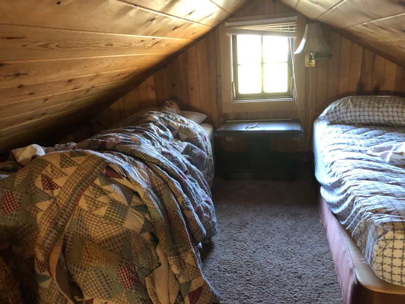
Joe in his quarters at last night’s cabin. The room did not have a high ceiling. 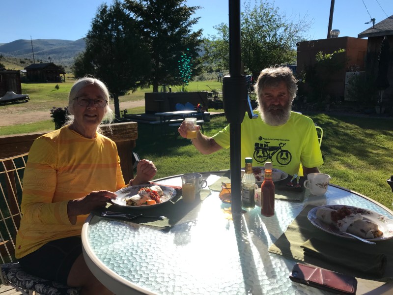
Delicious burrito breakfast and fruit. 
Chris and Mary Ann at 7,000 feet, atop the final mountain pass of our trek. 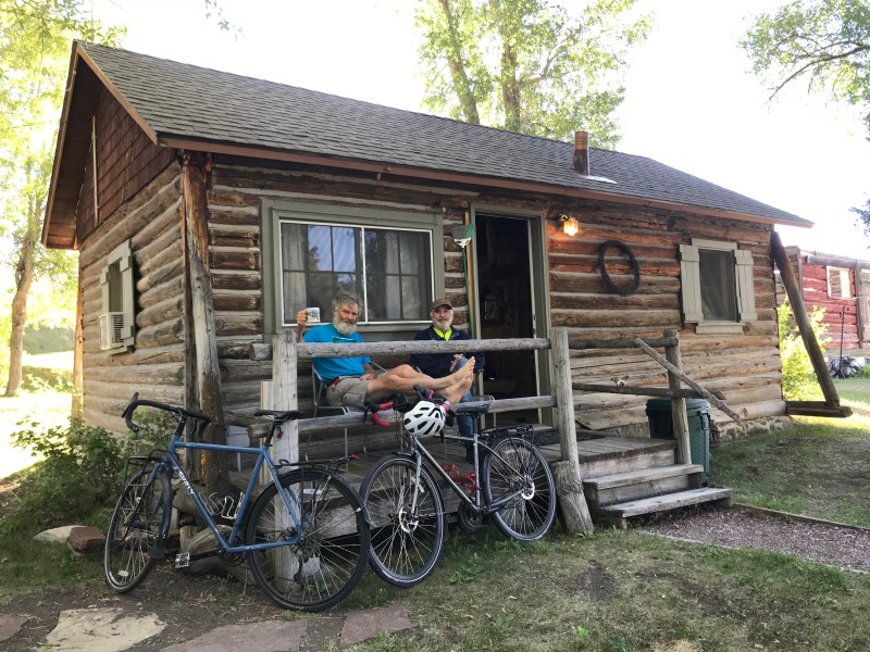
Home sweet home like the pioneer days in Nevada City, MT. Relaxing after our headwind, no shoulder ride up this canyon. 
Chris putting the heat of the road behind him. 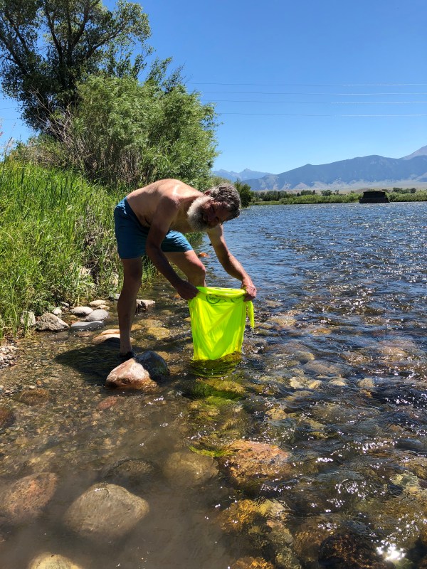
Following gentle suggestions from his fellow travelers, Chris washes his shirt in the Madison River. Discerning readers of this blog may have noticed that Chris has appeared in this shirt in every photo to date.
- Day 24: Ennis to Cameron, Montana
Today, our last full day of riding, was filled with stunning scenery and many indications we are now very close to Yellowstone. This includes, on the challenging side, much more traffic than we have experienced for much of the trip. Some of the campers we now share the road with are enormous and some of these tow full sized pickups or Jeeps. We looked back fondly tonight on the day we spent most of the morning climbing up a pass in remote Idaho through many switchbacks and shared the road with less than ten vehicles the entire magical morning.
On the other hand we’re able to start enjoying some of the amazing things which bring people to the Yellowstone area in the first place: stunningly beautiful mountains and streams, and the rich blue skies of high Montana .
We rode the entire day riding south in the valley of the Madison River, with the Madison Range directly to our east, climbing gradually all the way as we followed the Madison River upstream . Tomorrow we go into the Madison Range mountains and gently climb to West Yellowstone.
In the late afternoon today Chris and Joe took a side excursion ride up to Quake Lake, a lake which was formed in 1959 when there was a 7 plus earthquake here which caused a mile wide side of a mountain to break off and crash to the bottom of the canyon of the Madison River, creating a natural dam that then flooded the area upstream of it, resulting in a large lake which still exists, and remarkably contains the trunks of many trees which died in the flood – sixty two years ago.
With side excursions we covered 51 miles today and have now ridden well over 1,200 miles on this journey. On to Yellowstone tomorrow!

We’re in Big Sky country now. 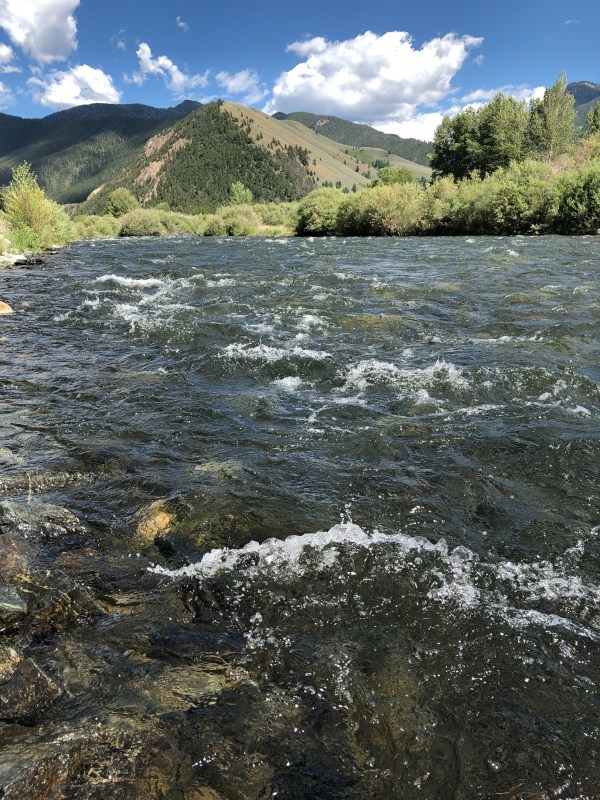
Sitting in the Madison River after an afternoon of hot pedalling. The air temp was 89 degrees in the shade today at 6,000 feet, which is way above normal . 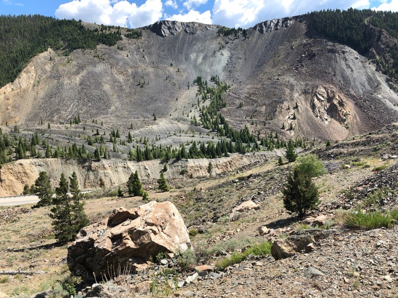
The mile-wide side of a mountain which crashed to the canyon floor below during an earthquake in 1959, creating Quake Lake. 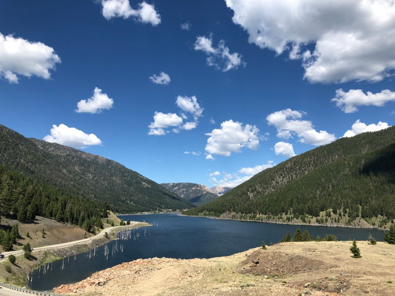
Quake Lake, formed when the Madison River ravine was dammed by the side of a mountain falling down into it during an earthquake in 1959. Note tree skeletons still standing 62 years later in the very cold water 
Riding downhill with a stiff wind at our back toward our lodging as the colors intensified before sunset. Biking heaven. 
Approaching our lodge on the evening of the last full day of riding 
Approaching the pass we will cross tomorrow. On the other side of that (Madison) Range lies Yellowstone Park.
- Day 25: Cameron to West Yellowstone, Montana (!)
We made it! After 1,248 miles of sometimes laborious but so often glorious biking, we pulled up to the west gate of Yellowstone Park today.
The start of the day was serene and pastoral as we rolled beside the Madison River through lush valleys and mountain notches, with remarkably little traffic. The last 8 miles or so were on a major highway, flat and straight, and featuring the trucks and campers that had blissfully disappeared for our morning ride. Chris pointed out that instead of having the end of our journey be on a major highway he would have preferred that we would have overcome another mountain pass today just before descending at high speed into West Yellowstone.
Though perhaps short on drama the moment was still poignant when we loaded our big bikes into a pickup for the ride to our friend Wanda Wilcox’s ranch. It’s bittersweet that tomorrow we will have no miles to go before we sleep.
After being picked up we enjoyed a spectacular ride in the truck over the Bear Tooth Byway to Red Lodge and then Absarokee, Montana and we are now ensconced at Wanda’s.
The final blog post on the bike trip, with summary reflections, tomorrow.

Chris and Mary Ann having breakfast along the Madison River. Joe’s beloved 1990’s era Trek 720, which has now crossed well more than half the country, in the foreground. 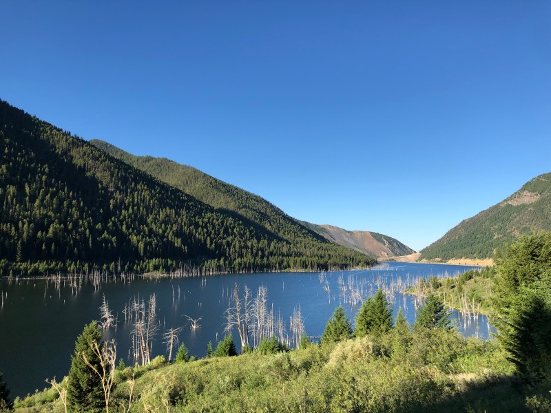
Quake Lake in the early morning. Many trees killed in the 1959 earthquake and subsequent flood still standing. 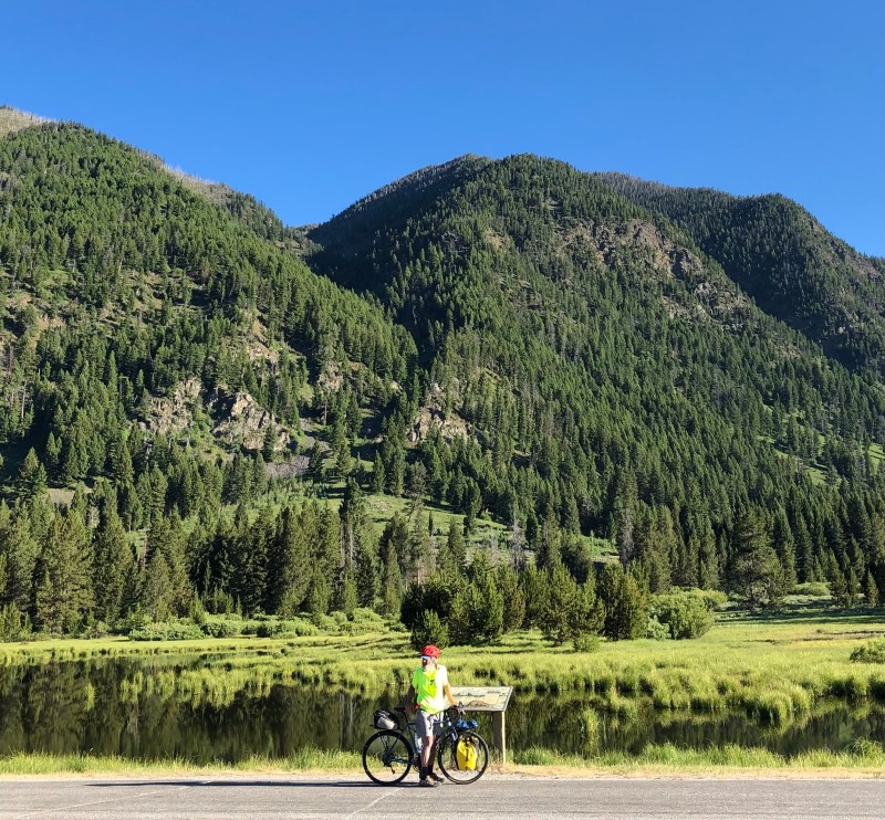
Chris read nearly every historical or scientific marker over the entire journey. 
Winding toward Yellowstone on a morning Chris accurately described as “serene”.
- Day 26: Absarokee, Montana
We are enjoying being on our friend Wanda Wilcox’s ranch. Leaving our bikes there we took a six mile hike up the canyon of the Stillwater River where it comes out of the Absaroka-Beartooth mountains, the tallest in Montana. Tonight we have a celebration dinner at the Grizzly Bar in Roscoe. Tomorrow, after a morning horseback ride, we head to Billings for our flights to Minneapolis and Vermont.
On our hike Chris, Mary Ann and I came up with some fun facts about our journey which is still so fresh in our minds, among them:
• 1,248 miles
• No flats or bike breakdowns
• No accidents or injuries. Two brief Emergency Room visits, one minor surgery without anesthetic outside at a picnic table when we were in remotest Idaho.
• ~21 days of the total of 25 with the wind at our back for at least most of the day.
• At least 50 separate renditions by Chris, while pedaling, of “Up on Cripple Creek” by The Band. The lyrics “When I get off if this mountain / you know where I’m gonna go…” resonated well with all of us. Other numbers in Chris’ rolling repertoire were selections from “Blonde on Blonde” and “Blood on the Tracks”, as well as “Carol” and “Little Queenie” by Chuck Berry.
• On the subject of Chuck Berry, Joe’s internal soundtrack often played Chuck Berry’s “Maybelline”: for example “As I was Motorvatin’ up over a hill / I saw Maybelline in a Coup de Ville” and “Rainwater flowin’ all under my hood / Knew that was doin’ my motor good” when riding was easier, “Ford got hot and wouldn’t do no mo’” when it was not.
• Perhaps 50,000 feet of cumulative vertical climb. There’s really no way to know, but the big climbs were followed by long downhills, and we were getting better at these climbs as the trip progressed. The climb after Wild Bird
• At least five visits by angels flying, luckily for us, close to the ground. These included the nurse practitioner who performed the above-mentioned medical procedure, and “Who was that man???” who appeared from who knows where with a pick-up and a seemingly bottomless supply of ice cold Gatorades just when we needed him most.
• Perhaps 50,000 feet of cumulative vertical climb. There’s no way to know, and the big climbs were followed by long cooling descents. We felt we were getting better at these as the trip progressed. Did we miss having a mountain pass to overcome today? Maybe a little! And the early morning climb all by ourselves out of Wild Bird was so gorgeous I don’t think any of us will ever forget the views from those switchbacks…
Chris and Mary Ann hiking in the Stillwater Canyon of the Beartooth-Absaroka range. 
The Stillwater River canyon. 
This is a low water year and yet the power of the cascading water was awesome.
- Day 27: Reflections From Joe
When bike touring in remote areas there’s lots of time to think. On this trip, through some of the remotest parts of the country, some brain space went to mileage calculations – what percent of the day’s ride has been completed at a given point, miles to go – but there was ample alone time for reflection. I thought a lot about lessons I could learn carry over from this bike tour into other aspects of my life. Here are some lessons I hope will stick with me as I go back to my life in the Twin Cities:
- Uphills and downhills are all relative, and all part of the journey. Especially when riding next to streams (as we did for much of our trip) it was often difficult to tell whether a stretch of road went uphill or downhill; as in an M.C. Escher drawing there were optical illusions where uphill stretches looked like downhills, and vice-versa. When we rode upstream along a river (as we did for instance for 71 miles along the Lochsa River) long uphill stretches seemed flat even though we knew we were climbing. Life lessons? Sometimes we can be gaining altitude and not even realizing it as long, as we keep moving forward. Uphills and downhills are all relative, and all part of the journey. Thinking about whether we were going uphill or downhill at any shorter-term point wasn’t helpful, and crowded out brain-space for more positive and productive thinking. What was important was to keep advancing, with hope and trust that we would get to our destination.
- Be conscious of, and thankful for, tailwinds. Tailwinds are out there helping us along on much of our journey, even if they’re so subtle and we can barely feel them. It’s easy to take for granted how much of a difference they can make in a journey. Moving forward I want to be more aware of, and grateful for, the gentle tailwinds at my back, especially family and friends. And I would like to provide more gentle tailwind for others; maybe the kind that’s so subtle that people aren’t even aware that it’s there, but that is gently helping them move forward on their journeys.
- Headwinds are part of the journey. As opposed to tailwinds, it’s challenging not to have headwinds front-of-mind, especially when we’re tired or struggling. But to whatever extent we can, it’s beneficial not to let them become too much of a focus. They’re temporary. They make us stronger – headwinds which were daunting on week one were much more manageable on week three because they had made us stronger. Most importantly, they’re part of the journey; we can’t move forward without them. And the tailwinds will return soon and feel all the sweeter when they do.
- Start early. Given the record-setting heat wave in the West we didn’t really have a choice, but this trip underscored that summer biking is best experienced in the early morning when the temps are cooler, the light warmer, the roads less travelled, mists in the fields, birds singing…. Time stood still. Per Van Morrison, these early morning rides stoned me to my soul.
- There are angels in our midst, and we can be one too. Like Lewis and Clark, whose route we largely followed for hundreds of miles, we encountered in our journey at least four Sacajawea-like angels who, very fortunately for us, were flying close to the ground. These people enabled us to keep moving forward at critical points when the mission was at risk, asking nothing in return. All of these folks had lives to lead and lots of other things to do rather than help us. All of them could have easily said no and kept on moving past us. But they stopped and were totally focused on helping us. We can do this too. We just need to see the opportunities, and then like these folks, stop what we’re doing to help. And not ask for anything in return except for the satisfaction of having helped others stay on track on their journeys.
Here’s a quote Becky from Adventure Cycling magazine about a long bike tour which Becky and I liked. “Remember the bigger goal… I will forever be grateful that I listened to that voice in me that told me to go.”
Special thanks to Chris and Mary Ann for taking a month away from their vegetable garden and other responsibilities to do this ride with me and make my dream of riding across the U.S. possible. Without their willingness, this journey could have been one which got pushed off from year to year until one realizes that it’s just not going to happen. Chris and Mary Ann overcame lots of challenges before we got to that Yellowstone sign. I’ll be forever grateful to them for saying “yes”.
Special thanks to Becky for her unwavering support and encouragement of this dream of crossing the U.S. on bikes with friends. Her positive, loving spirit was there for every mile of the journey.
And thank you – family and friends – for being gentle tailwinds helping us along….

With old friends Sherry Dugan, Wanda Wilcox and Tini Starkweather at the Grizzly Bar in Roscoe, Montana. Joe met Wanda almost 40 years ago when he responded to an ad she had placed at the Grizzly Bar for her brand new outfitting business.

© On The Road 2021 Sea to Shining Sea Bike Tour With Friends, 2021. Unauthorized use and/or duplication of this material without express and written permission from this site’s author and/or owner is strictly prohibited. Excerpts and links may be used, provided that full and clear credit is given to Joe Donnelly, Chris Tormey, and Mary Ann Tormey and On The Road 2021 Sea to Shining Sea Bike Tour With Friends with appropriate and specific direction to the original content.
Blog designed by Sarah Trinka, Twin Cities-area freelance copywriter & web content specialist. For inquiries, feel free to contact Sarah at sarah.trinka@gmail.com.

Congratulations Intrepid Riders. What an adventure. The blog is wonderful. We all need to become someone’s tail wind.
LikeLike
Way to go intrepid bikers! What an accomplishment and thank you for sharing these amazing photos and postings.
LikeLike